geospatial
geospatial news search results
Developer news items we found relating to geospatial
23 results
Quantum tech solves GPS denial
Monday, May 12, 2025 by Richard Harris
Q-CTRL, the global provider in quantum infrastructure software, recently announced successful field trials of a new generation of quantum-assured navigation solutions validated to outperform comparable conventional alternatives in challenging real-world settings. This marks the first achievement of commercial quantum advantage for any of the recently posed applications ...

Geospatial mapping system TrueView GO lands from GeoCue
Wednesday, August 7, 2024 by Freeman Lightner
GeoCue, a provider of geospatial solutions, recently announced the addition of the TrueView GO to its innovative product lineup, which includes TrueView drone and mobile mapping systems as well as LP360 3D point cloud software. This latest release marks GeoCue's entry into the handheld mapping arena, setting a new standard for portable, high-precision geos...

MarkLogic FastTrack UI toolkit from Progress
Wednesday, August 7, 2024 by Austin Harris
Progress, the provider of AI-powered infrastructure software, recently announced the availability of MarkLogic FastTrack, a UI toolkit for building data- and search-driven applications to visually explore complex connected data stored in the Progress MarkLogic platform. Applications built with the MarkLogic FastTrack UI toolkit help data users, analysts, ...

OpenAI acquires Rockset to enhance data capabilities
Monday, July 15, 2024 by Brittany Hainzinger
OpenAI has acquired Rockset, a company that specializes in real-time analytics databases, for almost $200 million. The acquisition has drawn attention and various reactions from influencers on the social media platform "X", revealing the Social Media Analytics Platform of GlobalData, a leading data and analytics company. OpenAI acquires Rockset, the real-ti...

Kinetica as a service is now available on Azure
Tuesday, October 26, 2021 by Austin Harris
Kinetica, the database for time and space, is now easily accessible as a service on Microsoft Azure, giving organizations real-time contextual analysis and location intelligence on massive data sets with reduced computing infrastructure and lower costs. Organizations across industries rely on Kinetica's vectorized database to analyze data from sensors and ma...
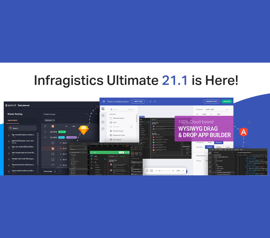
Infragistics Ultimate 21.1 builds on enhancements for developers
Monday, June 21, 2021 by Brittany Hainzinger
Infragistics announced the release of Infragistics Ultimate 21.1. The newest release breaks new ground in app design and developer collaboration with the world’s only digital product design platform, Indigo.Design, that lets teams build apps up to 10x faster. Infragistics Ultimate 21.1 builds on three key themes: Hyper-productivity enhancements for develo...

Test automation framework from Tavant gets update
Thursday, June 17, 2021 by Brittany Hainzinger
Tavant announced a new version of its end-to-end test automation framework, FIRE 5.0 (Framework for Intelligent and Rapid Execution). Tavant's FIRE 5.0 is a comprehensive tool and technology agnostic-test automation framework. This framework can orchestrate multiple automation tools and technologies, including (but not limited to) Selenium, Appium, Cypress, Protr...

App developer's salary in 2021
Monday, March 1, 2021 by Richard Harris
Economic uncertainty from the COVID-19 pandemic brought forth new challenges, drastically altering the needs and expectations of businesses on the IT front. While a tumultuous year for many industries, proprietary data from Hired and Vettery, the largest AI-driven hiring marketplace, found that the tech industry is highly resilient, with continued demand and job growth ...

Geospatial PaaS allow developers to integrate location in apps
Monday, February 1, 2021 by Brittany Hainzinger
Esri announced the launch of ArcGIS Platform, a geospatial platform as a service (PaaS) for developers that need to integrate location capabilities into their apps, business systems, and products. ArcGIS Platform gives developers direct access to Esri's powerful location services using the APIs and web frameworks of their choice. "ArcGIS Platform lets users ...

Enview announces 3D AI as a web application
Thursday, September 17, 2020 by Brittany Hainzinger
Enview launched Enview Explore™, a powerful web application that leverages AI and cloud computing to automatically process 3D data at unprecedented speed and scale. Additionally, Robert Cardillo, former director of the National Geospatial-Intelligence Agency (NGA), has joined the company’s Board of Directors. Following an oversubscribed round of funding in M...
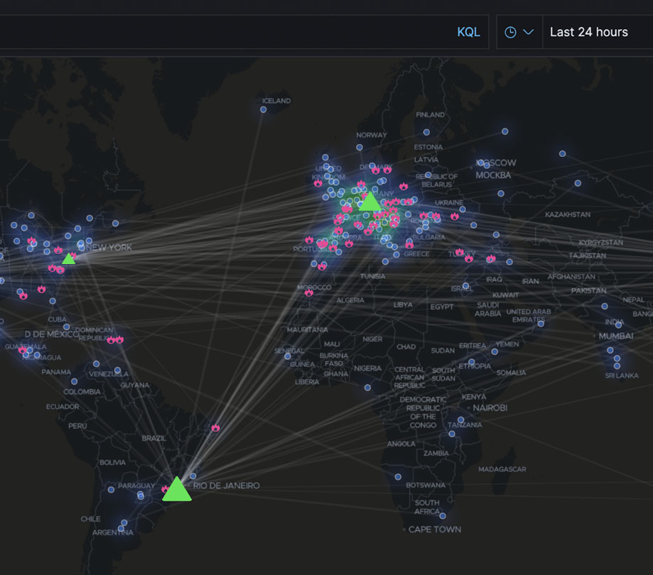
Elastic Stack 7.3 brings maps and more
Monday, August 5, 2019 by Austin Harris
Elastic has delivered Elastic Stack 7.3, which includes some very cool new features such as data frames, anomaly detection, elastic maps, and more. Check out all the highlights of the latest release below. Elastic Stack 7.3 highlights Data frames: a new feature that allows users to pivot their Elasticsearch data on the fly to create live entity-centric in...

Three years of edge use case research released
Wednesday, June 26, 2019 by Richard Harris
MobiledgeX has released more than three years of proprietary edge use case research and launches its interactive Edge Navigator tool to kick off industry-wide edge knowledge sharing and collaboration. Following interviews with more than 200 global businesses, the company found multi-player and cloud gaming, V2X communications, and Industrial IoT to be among the most via...

Esri Developer Summit 2019 recap
Wednesday, March 13, 2019 by Richard Harris
At the 2019 Esri Developer Summit in Palm Springs, CA, presentations and workshops focused on new capabilities for speed, science, and flexibility. Esri president Jack Dangermond opened the conference by recognizing the more than 2,100 developers in attendance for their tireless efforts to build location intelligence apps that make a difference in our world. Whether the...

ArangoDB NoSQL database platform updates to 3.4
Thursday, December 6, 2018 by Richard Harris
ArangoDB announced the GA release of ArangoDB 3.4 - a transactional database solution which enables developers to efficiently interact with multiple data models by using just one technology and one query language. Major new enhancements in ArangoDB 3.4 include ArangoSearch, a feature which transforms ArangoDB, when combined with traversals or joins in AQL, from a data r...

How inmemory computing is driving digital transformation technologies
Monday, August 7, 2017 by Nikita Ivanov
It increasingly seems that every business wants to become a data-driven software company. The success of Airbnb, Alibaba, Netflix and many others has CEOs, CIOs, and CDOs jumping on the digital transformation bandwagon and imagining all the possible ways they can leverage their intellectual property and unique data to deliver a service instead of just shipping products....

DOD releases PostgreSQL security technical implementation guide
Friday, March 24, 2017 by Richard Harris
Crunchy Data, a provider of open source PostgreSQL, has announced the publication of a PostgreSQL Security Technical Implementation Guide (STIG) by the U.S. Department of Defense (DoD), making PostgreSQL the first open source database with a STIG. Crunchy Data collaborated with the Defense Information Systems Agency (DISA) to evaluate PostgreSQL against the DoD’s securi...
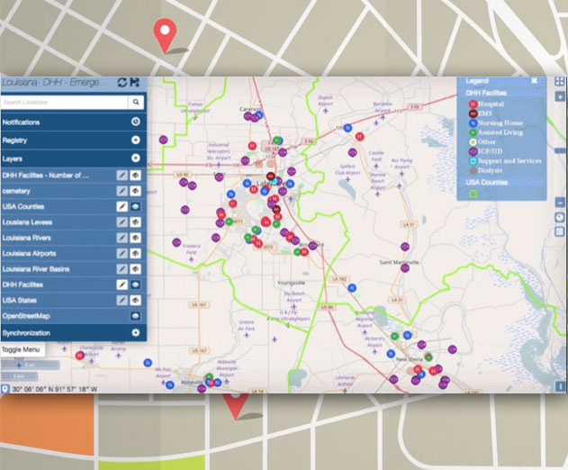
Boundless: The first complete supported open GIS platform
Friday, November 18, 2016 by Richard Harris
Eighty percent of data in the world today includes a location component. However, because of the issues associated with proprietary GIS solutions, many organizations are unable to tap into this data and gain valuable insights. Boundless is the first open source GIS solution of its kind, delivering the ultimate open GIS ecosystem, comprised of a unique combination...

SAP HANA express edition and key benefits developers should know about
Saturday, October 8, 2016 by Richard Harris
SAP, a large independent software developer, has released it's latest edition of HANA, an in-memory computing PaaS, called HANA express edition. SAP HANA can be used as an on-premise appliance, or for building and deploying to the cloud. A great tool for any real-time application development or analytics projects. The SAP HANA express edition gives developers all of th...
MarkLogic 9 NoSQL Database Released in Preview
Friday, May 13, 2016 by Richard Harris
MarkLogic has released MarkLogic 9 in preview, offering updates to the NoSQL database for integrating data from silos. MarkLogic is optimized for structured and unstructured data providing the ability allowing to store, manage, query and search across JSON, XML, RDF, geospatial data, text, and large binaries.New features in MarkLogic 9 include:Data Integration: MarkLogi...
Aerospike NoSQL Database Adds New Functionality for WebScale Applications
Wednesday, February 3, 2016 by Richard Harris
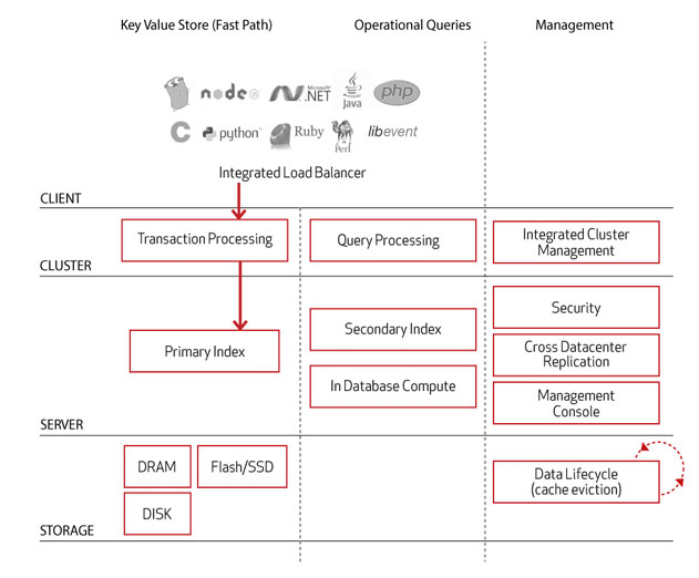
Aerospike has released the latest version of its NoSQL database offering new features that provide more personalized applications, more efficiency and greater stability across public and private clouds. The Aerospike platform is a distributed NoSQL database and key-value store architected for web-scale applications. It provides a high-performance database that can ...

VoltDB Adds Geospatial Support to Its Operational InMemory SQL Database
Saturday, January 30, 2016 by Richard Harris
VoltDB has released VoltDB v6.0, the latest version of its operational in-memory SQL database for fast data ingest/export. Now offering geospatial support, Version 6.0 adds to VoltDB’s in-memory parallel database architecture that scales transactions and analytics linearly while maintaining data consistency and high availability. VoltDB Version 6.0 provides a trans...
IBM Launches New Internet of Things Learning Portal for Developers
Friday, August 7, 2015 by Stuart Parkerson
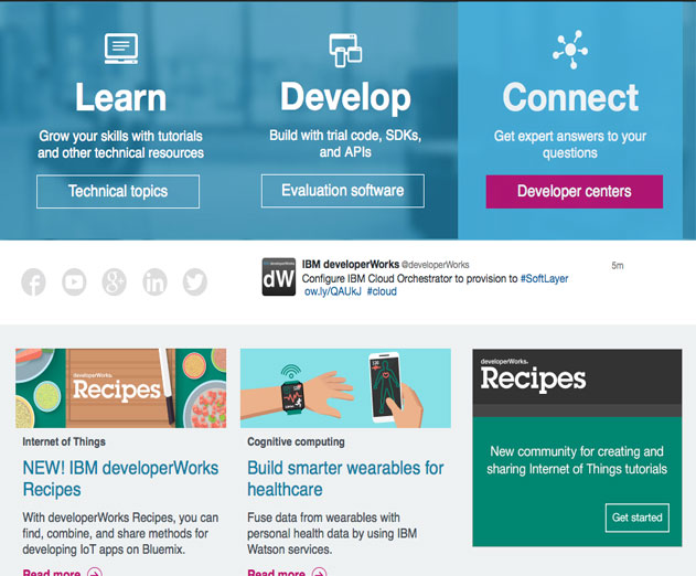
IBM has created a new IoT portal, IBM developerWorks Recipes, designed to help developers learn how to connect Internet of Things (IoT) devices to the cloud and how to use data coming from those connected devices.Through developerWorks Recipes, developers can access materials providing guidance in the creation, management and connection of IoT devices to each other and ...

Ignite UI For HTML5 and Jquery Controls
Tuesday, August 13, 2013 by Ron Beaman
Ignite UI is a set of advanced HTML and JavaScript user interface controls that enables developers to create browser based, touch enabled tablet, mobile and desktop applications. Ignite UI is based on jQuery Core, jQuery UI, jQuery Mobile JavaScript libraries and includes a complete set of 22 jQuery based mobile controls with support for adaptive CSS for the develo...
Featured Stories

Stay Updated
Sign up for our newsletter for the headlines delivered to youSuccessFull SignUp

|


