AirVisual's new air pollution data API is now available for developers
Tuesday, January 3, 2017

|
Richard Harris |
AirVisual is a company that provides the tools and information people need to thrive in polluted environments. By employing big data, artificial intelligence and Internet of Things technologies, AirVisual delivers user-friendly, simple solutions to optimize health and well-being, both indoors and out.
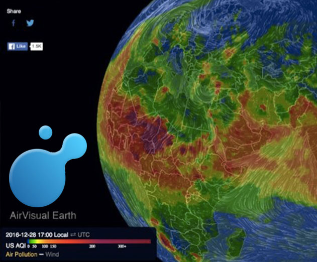
AirVisual Earth is the first 3D air pollution map to show the interaction of ambient particulate matters (PM2.5) levels and weather patterns. The mesmerizing interface allows viewers to spin the globe, zoom in and out, and toggle between combined PM2.5 and weather data, or just wind patterns alone; and track AQI (Air Quality Index) levels across the planet via vivid color-coded heat mapping.
"AirVisual Earth was developed to allow people to meaningfully relate to the air pollution problem" says Kelsey Duska, AirVisual Project Lead. "In visualizing pollution concentrations, we aim to clearly show the effect that our everyday emissions are having on the planet's health, as well as our own."
The mesmerizing map is generated from satellite imagery and data reported by over 10,000 monitoring stations, including government stations and crowdsourced data from their own PM2.5 air quality monitors. By incorporating their own network of monitoring stations, the platform even provides valuable air quality data for Pakistan, Saudi Arabia, Italy, Cambodia and the Philippines.
In response to the rise of public interest in the air pollution problem, they have made all of this data, spanning 8,000 key cities in more than 60 different countries, accessible to program developers via their newly launched API (Application Program Interface). The air quality and pollution API provides historical and forecast data, alongside real-time data.
"By providing developers access to AirVisual's extensive database, we're planting the seed for innovations to come," explains Duska. Companies will be able to integrate the API to develop new software and product features based on current and forecast air quality and weather information.

Become a subscriber of App Developer Magazine for just $5.99 a month and take advantage of all these perks.
MEMBERS GET ACCESS TO
- - Exclusive content from leaders in the industry
- - Q&A articles from industry leaders
- - Tips and tricks from the most successful developers weekly
- - Monthly issues, including all 90+ back-issues since 2012
- - Event discounts and early-bird signups
- - Gain insight from top achievers in the app store
- - Learn what tools to use, what SDK's to use, and more
Subscribe here


_cptybzmh.jpg)


